
7/4/2013
The best way to escape these hot days down in the Salt Lake Valley is a retreat into the mountains. Whether you enjoy strenuous peakbagging, high-country fishing, or a easier meadow and lakeside strolls, Red Castle, situated in on the north slope of the Uintas, will not disappoint.
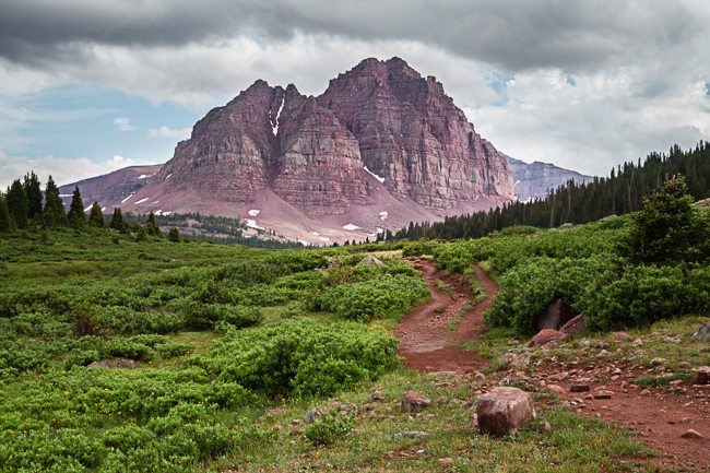
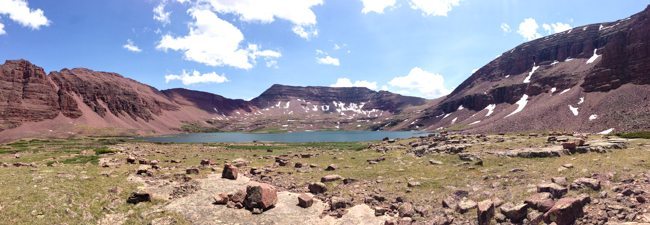
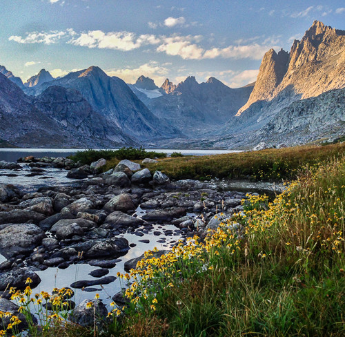
When I’m hiking, I like to have a destination in mind. I know they say “it’s all about the journey” and while I agree the journey is important, the satisfaction of reaching a specific and dramatic location at the end of the day is pretty darn satisfying. Red Castle supplies the dramatic location for this trip – the striking red sandstone cliffs rise out of a lush valley crossed with gurgling streams full of indiscriminate trout. Butting against either side of the red castle formation are alpine lakes known for their beauty and their cuttroat trout.
There two common ways to hike to Red Castle – an easy route and a hard route. They are both about the same distance (~12 miles) and I’ll speak to both of them. Also, a quick disclaimer – almost all of the images in this report were taken with my iPhone.
Bald Mountain Trail – The Hard Route
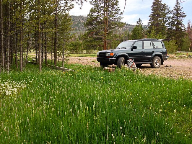
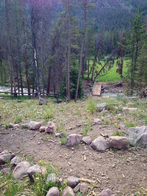
Bald Mountain Trail begins at the East Fork Blacks Fork Trailhead and will treat you incredible alpine vistas, paid for with your sweat. East Fork Blacks Fork trailhead is a nice location – campsites, meadows, and a sizeable river are all nearby. Head out of the parking lot, down towards the river and past the trailhead sign to the footbridge. Follow the path after the footbridge that heads south – it only goes that way for a short time before it forks and you head northeast, slightly away from the river. Don’t do as I did and immediately head left through the meadows – while they may be full of flowers, they will also be full of water.
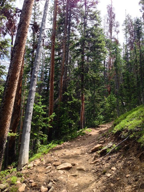
Heading north you eventually will come to a fork in the trail, complete with signs to orient yourself. Fill up your water bottle because you are about to hit the hardest and driest section of the day. The switchbacks rocket you up the mountain, gaining a little over 1000 ft in about 1.5 km. The higher you go, the better the views will be that peek through the trees. When you hit the long, straight northeast section you know you’re almost done. The trail climbs into a pine forest and flattens out into an eerily quiet stretch before breaking out into the Mansfield Meadows, which are fantastic.
Lets talk about water. You’ve got the obvious water source at the bottom of the switchbacks – its that sizeable river called the East Fork Blacks Fork. Your next source of water will be when you break out of the pine forest and into the Mansfield Meadows. There is a small brook flowing down through scattered rock where you can fill up – however, know that if there was a very dry winter and a very dry following summer, that stream may disappear leaving you high and dry for many miles. I hike with a low water philosophy, filling up from stream to stream as I go. After some distance when I arrive at a new water source, I down the remainder of my quart water bottle and fill up – purifying with the SteriPEN. The SteriPEN rocks, as long as it doesn’t run out of batteries.
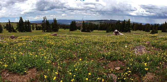
From here, the trail climbs gradually through meadows. In early July the meadows were laced with small yellow and purple flowers. The meadows are lush and green. Use the cairns to navigate the large open expanses, knowing you should be heading roughly southeast towards the east side of the sloping mountain in front of you. That’s Bald Mountain.
These meadows are one of my favorite parts of the hike. Looking out north, Wyoming stretches as far as you can see. All around is a carpet yellow flowers. The trail is uphill, but not too steep. It’s enjoyable. It’s a dream!
Moving right along, you’ll come to the east side of Bald Mountain and viola!, a nice little cornice with a mountain lake. That’s Bald Lake. Maybe this is a good time to sit and have a snack if you haven’t already. We like dried mangos for snacks. Congratulations, you are at the highest point of your days journey, sitting at 11,500 ft eating a nice little snack. Good job.
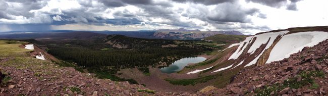
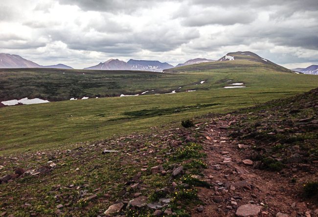
If Mansfield Meadows was a dream, then my experience on the next section of trail was “the kick” – assuming we are in the world of Inception. Walking the flat Bald Mountain ridge can be a gorgeous afternoon, or in my case it can be a “character building experience” in which nature reminds you of your place in the world. If you’ve been looking at the photos on this report you may have noticed a large amount of cloud cover. Cloud cover in the afternoon at 11,500 ft generally means its time for a mountain storm. Thunder, lightning, hail, pelting giant raindrops, and hikers running for their lives to get off that exposed ridgeline sums up the scene. Here’s a peek, moments before things got serious.
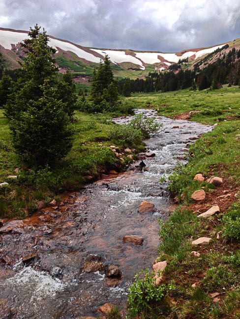
After descending rocky switchbacks from the ridge we are back in the lush valleys of forests and rivers and meadows. Bring some mosquito spray if you are coming in the summer – the stagnant water in the meadows coupled with the damage to the trails done by heavy footed horses makes for the perfect mosquito habitat. I found the little spray bottles of 40% deet Repel Max work well. They also make a non-deet eucalyptus version which worked, but had to be applied about every 30 minutes. At that rate, the little bottle doesn’t last long.
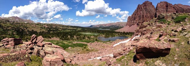
The rest of the day is pretty easy as far as hiking difficulty goes. Almost completely downhill. Continue on the trail to the joining of the East Fork Smith Fork trail and then head south. You can see Red Castle now. You’re close. Salvation is nigh.
East Fork Smith Fork Trail – the Easy Route
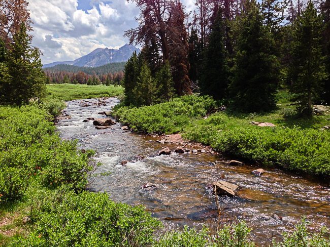
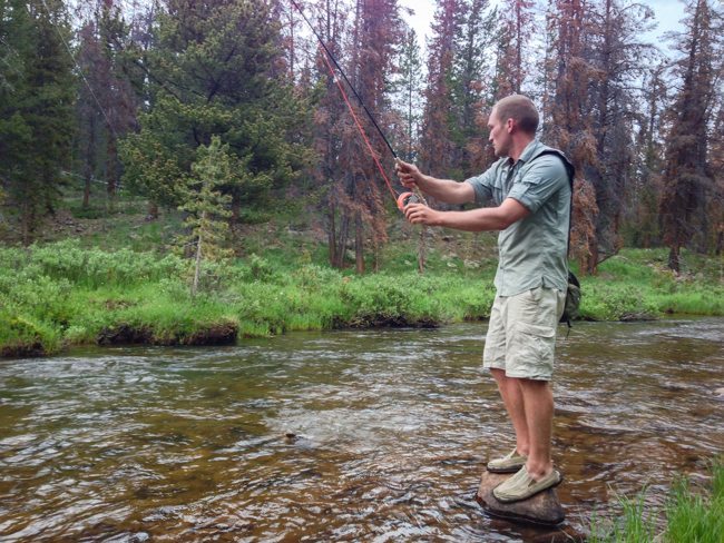
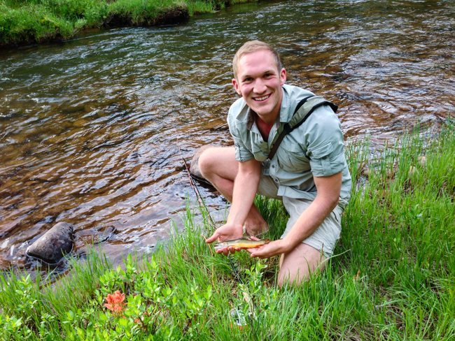
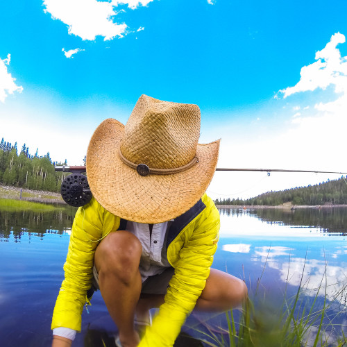
Opt for the East Fork Smith Fork Trail, beginning at China Meadows for a relatively flat and easy journey with the exception of a small set of switchbacks to get you up to the lakes. Amble down the trail through the meadow and over small streams and keep on the lookout for moose. Don’t hesitate to fish the East Fork Smith Fork river – the fish were biting as fast as I could get my fly in the water at dawn and dusk. Here’s the river, followed by the author landing a nice little brookie.
Red Castle Lakes
Keep walking and you will arrive at Lower Red Castle Lake. You’ll think to yourself – at long last I am here and lets take our packs off and lets sit for a while. But keep those packs on, keep moving, past the Lower Red Castle Lake. In fact, leave that lake behind. It’s full of mosquitos and there is no firewood to be had at those campsites – it’s all been picked clean. I give you this advice freely, and wishing that I had received it before I spent my first night tromping through the woods in search of anything larger than a twig, slapping mosquitos away from my face. Nonetheless, let’s have a look at the views from the Lower Red Lake campsite.
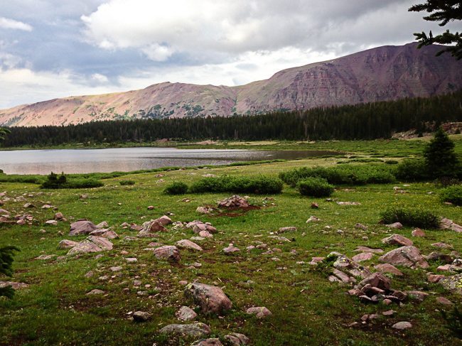
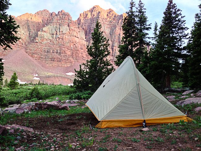
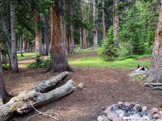
If you pass the Lower Red Castle Lake and hike just a bit farther, to the first stream crossing on the map, you will see myriad campsites in a gorgeous pine forest. You’ll have clean, clear running water, plenty of firewood, and some damn well built up campsites to call home. You may see an errant mosquito, but nothing compared to down by the lake. These campsites are also positioned perfectly for some day trips either down to the Lower Red Castle Lake, or up to Red Castle Lake proper – that’s the horseshoe one at 11,295 ft that is full of beautiful, hungry fish. Here’s a view of the forested campsite.
At dusk, a storm finally broke and the sun began to filter through the clouds. As it set, a soft and ethereal light filled the forest around us. At which time a doe approached our campsite, browsing the grass only 20 yards away. If this is Inception, it must be a multi-leveled dream.
I spend a couple days here, hike around and explore and fish the lakes. The scenery is gorgeous.
My only regret about this trip is that I couldn’t hang around for a whole week. The weather was wild, as it always is in the mountains, and that just serves to keep things interesting. The hiking was a blast, the views were incredible, and the fishing was great.
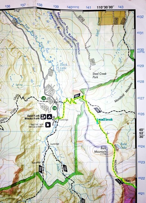
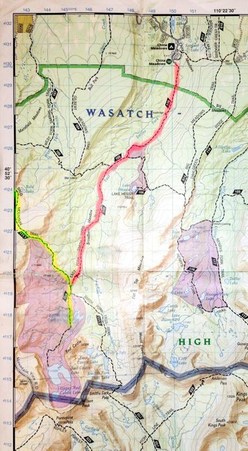
I’ve got some maps for you with the different routes highlighted. Yellow is the Bald Mountain Trail, red is the East Fork Smith Fork trail. My recommendation is for the Bald Mountain Trail, if you can swing it. I like to get above the treeline and see things that I generally can’t see on dayhikes in the Salt Lake Valley. Either way the cookie crumbles, the trails are nearly the same in length. The first map shows the western, beginning section of the Bald Mountain Trail. If you want a map for your hike, I recommend the NatGeo High Uintas Wilderness map. They are made of this cool plastic paper stuff that is waterpoof and cost only about $10.
Leave a reply